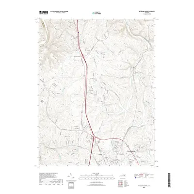
2019 Map of Richmond North
USGS Topo · Published 2019About this map
Richmond anchors the southeastern corner of this landscape, showing the suburban expansion of residential neighborhoods like Hillcrest and Arlington. The terrain to the north and west is defined by a dense network of drainage, where Otter Creek and its various branches, including West Fork Otter Creek and W Fork Otter Cr, carve through the rolling Bluegrass region. The boundary between Madison County and Fayette County is marked by the winding path of the Kentucky River in the extreme northwest. Historical land use and family legacies are visible through features like Jerry Clay Hill and the small settlement of Redhouse. Transport routes are dominated by the interstate and the Old Lexington Rd, which parallel each other while tracing the older corridors of travel between the regional centers. Smaller waterways such as Irvine Lick and Shallow Ford Cr reflect the deep-rooted agricultural and hydraulic history of this central Kentucky landscape.
Find a feature on this map
144 named features on this map. Tap any name to fly to it.
Don’t see what you’re looking for? This feature index may not catch every label — zoom into the map to look around manually.
Map Details
Editions of this 2019 Richmond North Map
This is the sole edition of this map. No revisions or reprints were ever made.
Other maps of this area

1892 · Richmond
USGS Topo · 1:125,000

1897 · Richmond
USGS Topo · 1:125,000

1952 · Valley View
USGS Topo · 1:24,000

1952 · Union City
USGS Topo · 1:24,000

1952 · Coletown
USGS Topo · 1:24,000

1952 · Kirksville
USGS Topo · 1:24,000

1952 · Ford
USGS Topo · 1:24,000

1952 · Winchester
USGS Topo · 1:24,000

1952 · Richmond North
USGS Topo · 1:24,000

1952 · Moberly
USGS Topo · 1:24,000