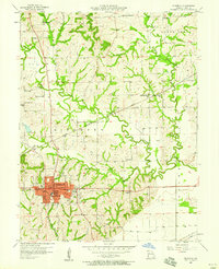
1957 Map of Richmond
USGS Topo · Published 1958About this map
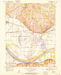
The city of Richmond serves as the central hub of this Ray County landscape, depicted shortly after the mid-century as a thriving community at the junction of significant regional rail lines. The Chicago Burlington and Quincy and Wabash RR intersect near the town center, highlighting a transport-driven economy that connects the surrounding agricultural uplands. Rural life is anchored by a dense network of country schoolhouses and family burial grounds, including Patton Sch and Nutter Cem. The physical geography is defined by the winding paths of the West Fork Crooked River and East Fork Crooked River, which carve through the terrain before joining the main Crooked River. Within the city limits, institutional markers like the Lincoln Sch, City Hall, and the County Hospital reflect the civic infrastructure of the era.
Find a feature on this map
47 named features on this map. Tap any name to fly to it.
Don’t see what you’re looking for? This feature index may not catch every label — zoom into the map to look around manually.
Map Details
Editions of this 1957 Richmond Map
2 editions found
Other maps of this area

1889 · Lexington
USGS Topo · 1:125,000

1894 · Independence
USGS Topo · 1:125,000

1949 · Lexington East
USGS Topo · 1:24,000

1949 · Lexington West
USGS Topo · 1:24,000

1950 · Lexington East
USGS Topo · 1:24,000

1950 · Kansas City
USGS Topo · 1:250,000
1950 · Camden
USGS Topo · 1:24,000
1950 · Lexington West
USGS Topo · 1:24,000
1951 · Camden
USGS Topo · 1:24,000

1953 · Moberly
USGS Topo · 1:250,000