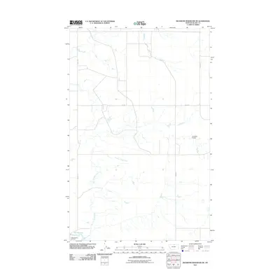
2011 Map of Richmond Reservoir SW
USGS Topo · Published 2011About this map
Dry Fork Battle Creek and Chouteau Coulee carve a network of drainages across this northern Montana landscape, illustrating the hydraulic character of Blaine County. The terrain is defined by its agricultural and water-management infrastructure, notably featuring the Twin Reservoir at the southern edge of the survey. The presence of the Miss Flaming Jet Dam signifies the regional reliance on localized water storage and control in an arid environment. A sparse grid of rural thoroughfares, including Middle Rd, Xeno Rd, and Bagan Rd, provides the primary access to this open country, where the section lines of the Public Land Survey System remain the dominant organizing principle for both roads and property boundaries.
Find a feature on this map
7 named features on this map. Tap any name to fly to it.
Don’t see what you’re looking for? This feature index may not catch every label — zoom into the map to look around manually.
Map Details
Editions of this 2011 Richmond Reservoir SW Map
This is the sole edition of this map. No revisions or reprints were ever made.
Other maps of this area

1904 · Yantic
USGS Topo · 1:62,500

1904 · Chinook
USGS Topo · 1:62,500

1912 · Zurich
USGS Topo · 1:125,000

1953 · Havre
USGS Topo · 1:250,000

1957 · Havre
USGS Topo · 1:250,000

1958 · Havre
USGS Topo · 1:250,000

1964 · Rabbit Hills
USGS Topo · 1:24,000

1964 · Telescope Coulee
USGS Topo · 1:24,000

1984 · Richmond Reservoir
USGS Topo · 1:24,000
1984 · Richmond Reservoir SW
USGS Topo · 1:24,000