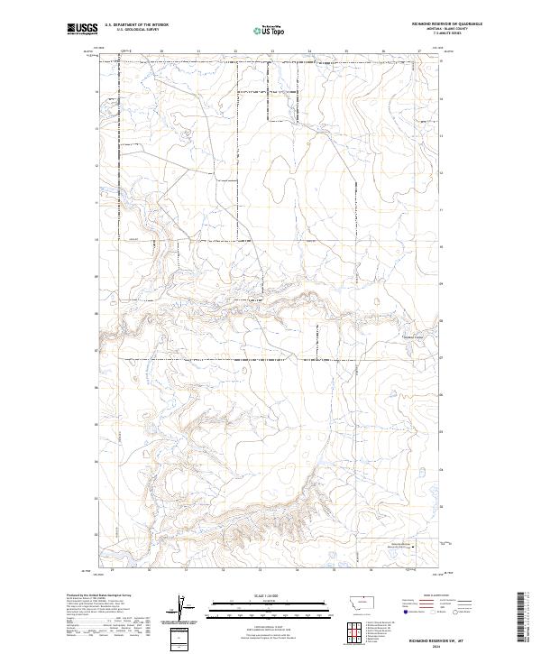
2024 Map of Richmond Reservoir SW
USGS Topo · Published 2024About this map
The Bethel Bruderthaler Mennonite Church Cem provides a focal point for genealogical interest in this rural corner of Blaine County. The landscape is defined by the winding course of Dry Fork Battle Creek as it carves through the undulating northern Montana plains. This area is characterized by high-desert drainage patterns, including the prominent Chouteau Coulee in the eastern portion of the survey. A sparse grid of local thoroughfares, such as Bagan Rd, Middle Rd, and Xeno Rd, facilitates movement through the expansive sections of T36N and T35N. The map reflects a modern view of this agricultural and grazing region, where land use remains tied to the natural watercourses and the historical footprints of local religious communities.
Find a feature on this map
11 named features on this map. Tap any name to fly to it.
Don’t see what you’re looking for? This feature index may not catch every label — zoom into the map to look around manually.
Map Details
Editions of this 2024 Richmond Reservoir SW Map
This is the sole edition of this map. No revisions or reprints were ever made.
Other maps of this area

1904 · Yantic
USGS Topo · 1:62,500

1904 · Chinook
USGS Topo · 1:62,500

1912 · Zurich
USGS Topo · 1:125,000

1953 · Havre
USGS Topo · 1:250,000

1957 · Havre
USGS Topo · 1:250,000

1958 · Havre
USGS Topo · 1:250,000

1964 · Rabbit Hills
USGS Topo · 1:24,000

1964 · Telescope Coulee
USGS Topo · 1:24,000

1984 · Richmond Reservoir
USGS Topo · 1:24,000
1984 · Richmond Reservoir SW
USGS Topo · 1:24,000