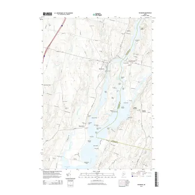
2014 Map of Richmond
USGS Topo · Published 2014About this map
Swan Island sits at the heart of this coastal Maine landscape, dividing the Kennebec River as it flows south toward Merrymeeting Bay. The map documents a historic riverine economy where settlements like Richmond and West Dresden face one another across the water, joined by the legacy of travel routes such as Old Ferry Rd. The density of family burial grounds, including Gaubert Cem and Forrest Hill Cem, speaks to generations of settlement along the riverbanks. To the west, the Abagadasset River meanders through tidal flats and lowlands, creating a complex network of points and coves like Theobald Point and Clay Cove. This detailed survey captures the 2014 state of these waterways, showing the persistent rural character of Sagadahoc County and Lincoln County as they meet at the river's edge.
Find a feature on this map
111 named features on this map. Tap any name to fly to it.
Don’t see what you’re looking for? This feature index may not catch every label — zoom into the map to look around manually.
Map Details
Editions of this 2014 Richmond Map
This is the sole edition of this map. No revisions or reprints were ever made.
Other maps of this area

1892 · Gardiner
USGS Topo · 1:62,500

1893 · Wiscasset
USGS Topo · 1:62,500

1893 · Boothbay
USGS Topo · 1:62,500

1894 · Bath
USGS Topo · 1:62,500

1920 · Bath
USGS Topo · 1:62,500

1941 · Boothbay
USGS Topo · 1:62,500

1943 · Gardiner
USGS Topo · 1:62,500

1943 · Boothbay
USGS Topo · 1:62,500

1944 · Wiscasset
USGS Topo · 1:62,500

1944 · Boothbay
USGS Topo · 1:62,500