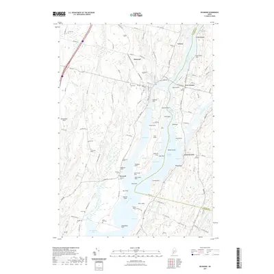
2021 Map of Richmond
USGS Topo · Published 2021About this map
Swan Island sits prominently in the Kennebec River, dividing the current between Richmond and West Dresden. This 2021 survey illustrates a landscape defined by the intricate waterways of the Midcoast region, where the Abagadasset River and Eastern River converge into Merrymeeting Bay. The map is particularly dense with small family and community burial grounds, such as Evergreen Cem, Cotton Cem, and Barker Cem, which are scattered throughout the rural uplands and riverbanks. Settlements like Iceboro and South Dresden are situated along the river corridors, reflecting a long-standing reliance on the tidal waters. On Swan Island, the presence of the Swan Island Cem and labels like Shipyard Point hint at the island's historical habitation and maritime industry, even as much of the interior is dominated by Wade Pond and various marshes.
Find a feature on this map
123 named features on this map. Tap any name to fly to it.
Don’t see what you’re looking for? This feature index may not catch every label — zoom into the map to look around manually.
Map Details
Editions of this 2021 Richmond Map
This is the sole edition of this map. No revisions or reprints were ever made.
Other maps of this area

1892 · Gardiner
USGS Topo · 1:62,500

1893 · Wiscasset
USGS Topo · 1:62,500

1893 · Boothbay
USGS Topo · 1:62,500

1894 · Bath
USGS Topo · 1:62,500

1920 · Bath
USGS Topo · 1:62,500

1941 · Boothbay
USGS Topo · 1:62,500

1943 · Gardiner
USGS Topo · 1:62,500

1943 · Boothbay
USGS Topo · 1:62,500

1944 · Wiscasset
USGS Topo · 1:62,500

1944 · Boothbay
USGS Topo · 1:62,500