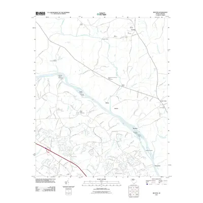
2011 Map of Richtex
USGS Topo · Published 2011About this map
The Broad River serves as the central geographic axis for this South Carolina landscape, punctuated by several notable shoals including Freshley Shoals, Chapel Shoals, and Bookman Shoals. Small islands like Haltiwanger Island, Huffman Island, and Hickory Island break the river's path as it flows past the settlements of Richtex and Littleton. The region is defined by a network of drainage systems including Hollinshead Creek, Boone Creek, and the Little River, which joins the main channel near Browns Bridge.
Find a feature on this map
121 named features on this map. Tap any name to fly to it.
Don’t see what you’re looking for? This feature index may not catch every label — zoom into the map to look around manually.
Map Details
Editions of this 2011 Richtex Map
This is the sole edition of this map. No revisions or reprints were ever made.
Other maps of this area

1904 · Columbia
USGS Topo · 1:125,000

1941 · Spartanburg
USGS Topo · 1:250,000

1946 · Irmo
USGS Topo · 1:24,000

1947 · Columbia North
USGS Topo · 1:24,000

1947 · Richtex
USGS Topo · 1:24,000

1948 · Irmo
USGS Topo · 1:24,000

1948 · Columbia North
USGS Topo · 1:24,000

1949 · Richtex
USGS Topo · 1:24,000

1949 · Irmo NE
USGS Topo · 1:24,000

1953 · Spartanburg
USGS Topo · 1:250,000