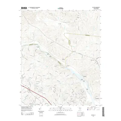
2014 Map of Richtex
USGS Topo · Published 2014About this map
The Broad River flows through this Piedmont landscape, carving a boundary between Fairfield and Richland counties. The river is characterized by numerous navigation challenges and landmarks, including Freshley Shoals, Chapel Shoals, and Bookman Shoals, alongside notable landforms like Haltiwanger Island and Bookman Island. These river features historically influenced the placement of early settlements and river crossings in the region.
Find a feature on this map
158 named features on this map. Tap any name to fly to it.
Don’t see what you’re looking for? This feature index may not catch every label — zoom into the map to look around manually.
Map Details
Editions of this 2014 Richtex Map
This is the sole edition of this map. No revisions or reprints were ever made.
Other maps of this area

1904 · Columbia
USGS Topo · 1:125,000

1941 · Spartanburg
USGS Topo · 1:250,000

1946 · Irmo
USGS Topo · 1:24,000

1947 · Columbia North
USGS Topo · 1:24,000

1947 · Richtex
USGS Topo · 1:24,000

1948 · Irmo
USGS Topo · 1:24,000

1948 · Columbia North
USGS Topo · 1:24,000

1949 · Richtex
USGS Topo · 1:24,000

1949 · Irmo NE
USGS Topo · 1:24,000

1953 · Spartanburg
USGS Topo · 1:250,000