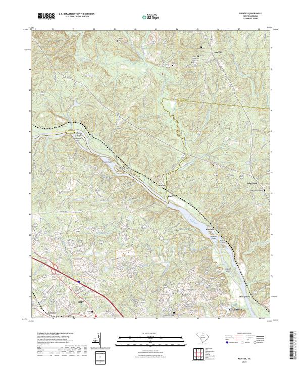
2024 Map of Richtex
USGS Topo · Published 2024About this map
The Broad River and its major tributary, the Little River, dominate this modern landscape at the Fairfield Co and Richland Co border. The river's historical importance for navigation and early industry is marked by numerous hazards and landforms, including Freshley Shoals, Chapel Shoals, and Bookman Shoals, alongside notable river islands like Haltiwanger Island and Huffman Island. Settlement patterns are concentrated in the southern portion, where the expansion of Irmo and Ballentine meet the CSX rail line, which continues north through the namesake community of Richtex. Local history and genealogy are preserved through numerous family and congregational sites, such as the County Grove Baptist Church Cem, Cedar Creek Church Graveyard, and Saint Pauls Church Graveyard. Smaller named communities like Bookman, Littleton, and Jennings reflect the rural character that still persists along the winding Monticello Road corridor.
Find a feature on this map
153 named features on this map. Tap any name to fly to it.
Don’t see what you’re looking for? This feature index may not catch every label — zoom into the map to look around manually.
Map Details
Editions of this 2024 Richtex Map
This is the sole edition of this map. No revisions or reprints were ever made.
Other maps of this area

1904 · Columbia
USGS Topo · 1:125,000

1941 · Spartanburg
USGS Topo · 1:250,000

1946 · Irmo
USGS Topo · 1:24,000

1947 · Columbia North
USGS Topo · 1:24,000

1947 · Richtex
USGS Topo · 1:24,000

1948 · Irmo
USGS Topo · 1:24,000

1948 · Columbia North
USGS Topo · 1:24,000

1949 · Richtex
USGS Topo · 1:24,000

1949 · Irmo NE
USGS Topo · 1:24,000

1953 · Spartanburg
USGS Topo · 1:250,000