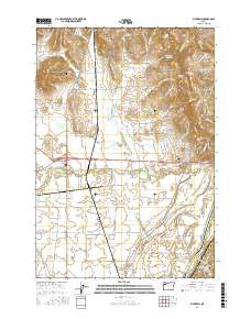
2017 Map of Rickreall
USGS Topo · Published 2017About this map
The community of Rickreall stands at the heart of this landscape, where several valley waterways converge near the base of the Eola Hills. This survey documents a complex network of agricultural drainages and natural sloughs, including Baskett Slough and Mud Slough, which define the low-lying terrain west of the Willamette River. Significant local landmarks include the prominent Holmes Gap to the north and the southern extent of the Salem Hills near the border of Polk and Marion counties.
Find a feature on this map
80 named features on this map. Tap any name to fly to it.
Don’t see what you’re looking for? This feature index may not catch every label — zoom into the map to look around manually.
Map Details
Editions of this 2017 Rickreall Map
This is the sole edition of this map. No revisions or reprints were ever made.
Other maps of this area

1914 · Independence
USGS Topo · 1:31,680

1915 · Rickreall
USGS Topo · 1:31,680

1915 · Eola
USGS Topo · 1:31,680

1915 · Sidney
USGS Topo · 1:31,680

1917 · Salem
USGS Topo · 1:62,500

1922 · Airlie
USGS Topo · 1:31,680

1924 · Mc Minnville
USGS Topo · 1:48,000

1926 · Mc Minnville
USGS Topo · 1:62,500

1940 · McMinnville
USGS Topo · 1:62,500

1940 · Salem
USGS Topo · 1:62,500