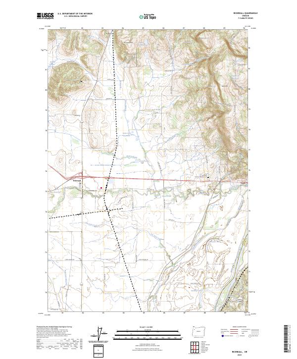
2023 Map of Rickreall
USGS Topo · Published 2023About this map
Rickreall and Eola anchor this Polk County landscape, which is defined by the significant agricultural and conservation zones between the Willamette River and the rising Eola Hills. The northern portion of the map is dominated by the Baskett Slough National Wildlife Refuge, a protected wetland area fed by the waters of Baskett Slough and Mud Slough. This hydrological network is essential to the valley floor's character, with features like Ash Swale and Goodwin Branch Mud Slough illustrating the intricate drainage patterns of the region.
Find a feature on this map
82 named features on this map. Tap any name to fly to it.
Don’t see what you’re looking for? This feature index may not catch every label — zoom into the map to look around manually.
Map Details
Editions of this 2023 Rickreall Map
This is the sole edition of this map. No revisions or reprints were ever made.
Other maps of this area

1914 · Independence
USGS Topo · 1:31,680

1915 · Rickreall
USGS Topo · 1:31,680

1915 · Eola
USGS Topo · 1:31,680

1915 · Sidney
USGS Topo · 1:31,680

1917 · Salem
USGS Topo · 1:62,500

1922 · Airlie
USGS Topo · 1:31,680

1924 · Mc Minnville
USGS Topo · 1:48,000

1926 · Mc Minnville
USGS Topo · 1:62,500

1940 · McMinnville
USGS Topo · 1:62,500

1940 · Salem
USGS Topo · 1:62,500