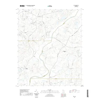
2020 Map of Rico
USGS Topo · Published 2020About this map
The Chattahoochee River carves a winding path through this region, serving as a natural boundary between Douglas, Carroll, Fulton, and Coweta counties. This area is defined by its small, scattered settlements including Fairplay, McWhorter, and Rico, connected by a network of rural roads such as Capps Ferry Rd and Campbellton Redwine Rd. The map illustrates a landscape of varied water features, from the quiet waters of Jones Ferry Road Lake and Wompum Lake to several creeks like Hurricane Cr and Wolf Cr. For local historians and genealogists, the placement of County Line Cem, Bethel Cem, and Andrews Cem provides essential landmarks for tracing heritage in this part of Georgia. A notable terrain feature, Devils Den, sits just north of the Douglas and Carroll county lines, adding local character to the topography.
Find a feature on this map
125 named features on this map. Tap any name to fly to it.
Don’t see what you’re looking for? This feature index may not catch every label — zoom into the map to look around manually.
Map Details
Editions of this 2020 Rico Map
This is the sole edition of this map. No revisions or reprints were ever made.
Other maps of this area

1891 · Marietta
USGS Topo · 1:125,000

1895 · Marietta
USGS Topo · 1:125,000

1897 · Marietta
USGS Topo · 1:125,000

1901 · Marietta
USGS Topo · 1:125,000

1953 · Atlanta
USGS Topo · 1:250,000

1954 · Palmetto
USGS Topo · 1:24,000

1954 · Campbellton
USGS Topo · 1:24,000

1957 · Atlanta
USGS Topo · 1:250,000

1958 · Rico
USGS Topo · 1:24,000

1958 · Atlanta
USGS Topo · 1:250,000
Featured Places
- Chattahoochee Hills, GA
- Saint Andrews Country Club Estates, GA
- Basket Creek, GA
- Cheviot Hills, GA
- Hannah, GA