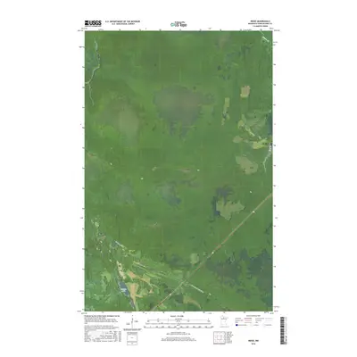
2016 Map of Ridge
USGS Topo · Published 2016About this map
Seretha Lake and the surrounding wetlands of Koochiching County dominate this landscape in the northern reaches of Minnesota. The terrain is characterized by a dense network of water bodies and marshlands, with drainage provided by Hay Cr and Dinner Cr. The human footprint in this part of the north woods is defined by solitary access routes like Gemmell Ridge Rd and Gemmell Ridge Forest Rd, which cut through the township sections of T153N R27W and T152N R27W. This 2016 survey illustrates the balance between managed forest lands and the natural hydrology of the region, where roads often follow the subtle higher ground of ridges to navigate the pervasive wet soils.
Find a feature on this map
11 named features on this map. Tap any name to fly to it.
Don’t see what you’re looking for? This feature index may not catch every label — zoom into the map to look around manually.
Map Details
Editions of this 2016 Ridge Map
This is the sole edition of this map. No revisions or reprints were ever made.
Other maps of this area

1918 · Zora
USGS Topo · 1:62,500

1919 · Zora
USGS Topo · 1:62,500

1919 · Lundgren
USGS Topo · 1:62,500

1919 · Gemmell
USGS Topo · 1:62,500

1919 · Margie
USGS Topo · 1:62,500

1954 · Bemidji
USGS Topo · 1:250,000

1954 · Hibbing
USGS Topo · 1:250,000

1954 · Roseau
USGS Topo · 1:250,000

1954 · International Falls
USGS Topo · 1:250,000

1957 · Roseau
USGS Topo · 1:250,000