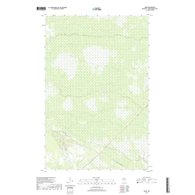
2019 Map of Ridge
USGS Topo · Published 2019About this map
Gemmell Ridge forms the primary topographic relief in this northern Minnesota landscape, a distinct landform cutting through the surrounding lowlands of Koochiching County. The map shows a largely undeveloped expanse defined by its wetlands and small water bodies, including Seretha Lake in the southwest and the narrow channels of Dimler Cr and Hay Cr. This modern survey illustrates the current road network that facilitates access through the timbered terrain, most notably Gemmell Ridge Rd and the Gemmell Ridge Forest Rd. These corridors, along with the state highway corridor numbered 71, trace the higher ground of the ridge, while the vast majority of the quadrangle remains an intricate pattern of peatlands and intermittent drainage common to the North Woods.
Find a feature on this map
13 named features on this map. Tap any name to fly to it.
Don’t see what you’re looking for? This feature index may not catch every label — zoom into the map to look around manually.
Map Details
Editions of this 2019 Ridge Map
This is the sole edition of this map. No revisions or reprints were ever made.
Other maps of this area

1918 · Zora
USGS Topo · 1:62,500

1919 · Zora
USGS Topo · 1:62,500

1919 · Lundgren
USGS Topo · 1:62,500

1919 · Gemmell
USGS Topo · 1:62,500

1919 · Margie
USGS Topo · 1:62,500

1954 · Bemidji
USGS Topo · 1:250,000

1954 · Hibbing
USGS Topo · 1:250,000

1954 · Roseau
USGS Topo · 1:250,000

1954 · International Falls
USGS Topo · 1:250,000

1957 · Roseau
USGS Topo · 1:250,000