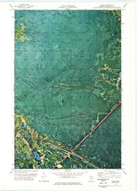
1973 Map of Ridge
USGS Topo · Published 1976About this map
Pine Island State Forest dominates this topographic study of northern Koochiching County, showing a landscape defined by expansive peatlands and managed timber. The orthophotomap format, derived from 1969 aerial photography, provides a rare visual of the forest canopy and drainage patterns in this remote region. In the south, Seretha Lake is a primary water feature, supported by a Public Access point that highlights the area's value for local recreation. Movement through the dense terrain is dictated by a few critical arteries, including the Gemmell Road and a designated Winter Trail, reflecting the seasonal logistics of logging and transit in Minnesota's boggy northern interior. This survey captures the intersection of state land management and the natural hydrology of the forest during the early 1970s.
Find a feature on this map
6 named features on this map. Tap any name to fly to it.
Don’t see what you’re looking for? This feature index may not catch every label — zoom into the map to look around manually.
Map Details
Editions of this 1973 Ridge Map
This is the sole edition of this map. No revisions or reprints were ever made.
Other maps of this area

1918 · Zora
USGS Topo · 1:62,500

1919 · Zora
USGS Topo · 1:62,500

1919 · Lundgren
USGS Topo · 1:62,500

1919 · Gemmell
USGS Topo · 1:62,500

1919 · Margie
USGS Topo · 1:62,500

1954 · Bemidji
USGS Topo · 1:250,000

1954 · Hibbing
USGS Topo · 1:250,000

1954 · Roseau
USGS Topo · 1:250,000

1954 · International Falls
USGS Topo · 1:250,000

1957 · Roseau
USGS Topo · 1:250,000