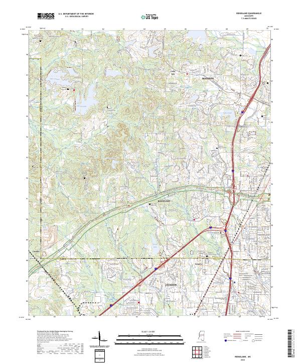
2024 Map of Ridgeland
USGS Topo · Published 2024About this map
The northern reaches of Jackson and the evolving suburban landscapes of Madison and Ridgeland are captured in this recent survey. The area is defined by a dense network of modern infrastructure and residential development, yet it retains deep historical roots visible through numerous small family and community burial grounds like Holland Family Cem and the Taylor Simpson Cem. The historic Natchez Trace Parkway and the accompanying Natchez Trace National Scenic Trl cut diagonally across the terrain, preserving a corridor of green space amidst the expanding street grids of W Jackson St and Colony Park Blvd. In the southern portion of the sheet, the campus of Tougaloo College and the surrounding community of Tougaloo stand as significant cultural landmarks. The landscape is also dotted with numerous water bodies, including Lake Lorman and Lake Cavalier, which highlight the region's managed water systems and recreational focus.
Find a feature on this map
180 named features on this map. Tap any name to fly to it.
Don’t see what you’re looking for? This feature index may not catch every label — zoom into the map to look around manually.
Map Details
Editions of this 2024 Ridgeland Map
This is the sole edition of this map. No revisions or reprints were ever made.
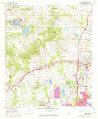
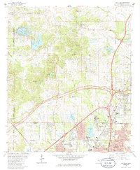
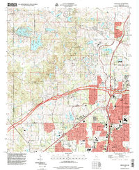
Historical Maps of Norwood Through Time
4 maps found