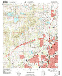
1998 Map of Ridgeland
USGS Topo · Published 1998About this map
The rapid northward expansion of the Mississippi capital is clearly visible in this late-1990s record of the area between Jackson and Madison. The landscape is a mix of educational institutions and residential development, anchored by the historic campus of Tougaloo College and the specialized Jackson College of Ministries. Transportation corridors dictate the local geography, with the Natchez Trace Parkway cutting diagonally through the center, while the Illinois Central railroad serves the eastern corridor near Ridgeland.
Find a feature on this map
58 named features on this map. Tap any name to fly to it.
Don’t see what you’re looking for? This feature index may not catch every label — zoom into the map to look around manually.
Map Details
Editions of this 1998 Ridgeland Map
This is the sole edition of this map. No revisions or reprints were ever made.
Other maps of this area

1903 · Jackson
USGS Topo · 1:125,000

1905 · Jackson
USGS Topo · 1:48,000

1908 · Jackson
USGS Topo · 1:62,500

1934 · Raymond
USGS Topo · 1:48,000

1937 · Raymond
USGS Topo · 1:62,500

1942 · Raymond
USGS Topo · 1:62,500

1955 · Jackson
USGS Topo · 1:250,000

1961 · Jackson
USGS Topo · 1:250,000

1961 · Canton
USGS Topo · 1:62,500

1962 · Jackson
USGS Topo · 1:250,000