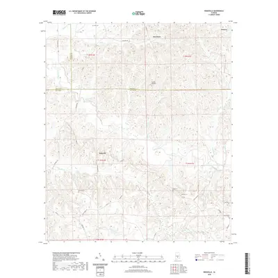
2020 Map of Ridgeville
USGS Topo · Published 2020About this map
Macedonia and Ridgeville anchor this 2020 landscape where the borders of Lowndes, Wilcox, and Butler counties converge. The terrain is defined by a dense network of ridges and watercourses, including the central Cedar Creek and its many tributaries like Wolf Cr and Ishums Cr. This modern survey details the persistent rural settlement patterns of the Alabama Black Belt, showing how contemporary routes like Co Rd 12 and Co Hwy 19 follow the ancient topography of the land.
Find a feature on this map
39 named features on this map. Tap any name to fly to it.
Don’t see what you’re looking for? This feature index may not catch every label — zoom into the map to look around manually.
Map Details
Editions of this 2020 Ridgeville Map
This is the sole edition of this map. No revisions or reprints were ever made.
Other maps of this area

1953 · Montgomery
USGS Topo · 1:250,000

1953 · Andalusia
USGS Topo · 1:250,000

1956 · Montgomery
USGS Topo · 1:250,000

1957 · Montgomery
USGS Topo · 1:250,000

1957 · Andalusia
USGS Topo · 1:250,000

1957 · Braggs
USGS Topo · 1:62,500

1971 · Greenville West
USGS Topo · 1:24,000

1971 · Fort Dale
USGS Topo · 1:24,000

1981 · Pine Apple North
USGS Topo · 1:24,000
1981 · Mount Willing
USGS Topo · 1:24,000