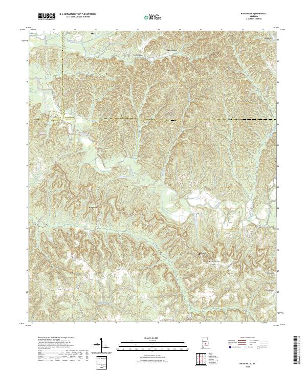
2024 Map of Ridgeville
USGS Topo · Published 2024About this map
Ridgeville and the surrounding Butler County countryside are defined by a network of creeks and ridges that have historically dictated local transport and settlement. The landscape is carved by watercourses like Wolf Creek and Cedar Creek, while prominent elevations like County Line Hill mark the boundaries of local movement. This map details the intersection of several rural corridors, including Ridge Rd and Macedonia Rd, which link the small communities of Macedonia and Palmyra. For genealogists, the map is particularly valuable for its precise locations of family-named burial grounds. Significant sites such as the Thompson Cem, Crenshaws Cem, and Manningham Cem are preserved here, offering a look at the historical footprint of rural families in this part of Alabama.
Find a feature on this map
37 named features on this map. Tap any name to fly to it.
Don’t see what you’re looking for? This feature index may not catch every label — zoom into the map to look around manually.
Map Details
Editions of this 2024 Ridgeville Map
This is the sole edition of this map. No revisions or reprints were ever made.
Other maps of this area

1953 · Montgomery
USGS Topo · 1:250,000

1953 · Andalusia
USGS Topo · 1:250,000

1956 · Montgomery
USGS Topo · 1:250,000

1957 · Montgomery
USGS Topo · 1:250,000

1957 · Andalusia
USGS Topo · 1:250,000

1957 · Braggs
USGS Topo · 1:62,500

1971 · Greenville West
USGS Topo · 1:24,000

1971 · Fort Dale
USGS Topo · 1:24,000

1981 · Pine Apple North
USGS Topo · 1:24,000
1981 · Mount Willing
USGS Topo · 1:24,000