
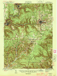
1944 Map of Ridgway
USGS Topo · Published 1944About this map
Industrial rail corridors and deep-valley coal operations define this 1940s landscape in Elk County. The Clarion River and West Creek anchor the northern settlements of Johnsonburg and St. Marys, where the Pennsylvania and Baltimore and Ohio railroads converge to support the region's manufacturing and timber heritage. To the south, the topography is dominated by the extraction economy of the Toby Mine and Kyler Mine, alongside small mining communities like Dagus Mines and Byrnedale.
Find a feature on this map
100 named features on this map. Tap any name to fly to it.
Don’t see what you’re looking for? This feature index may not catch every label — zoom into the map to look around manually.
Map Details
Editions of this 1944 Ridgway Map
3 editions found
Other maps of this area

1922 · Du Bois
USGS Topo · 1:62,500

1924 · Du Bois
USGS Topo · 1:62,500

1929 · Clearfield
USGS Topo · 1:48,000

1929 · Penfield
USGS Topo · 1:62,500

1932 · Clearfield
USGS Topo · 1:62,500

1932 · Penfield
USGS Topo · 1:62,500

1934 · Kane
USGS Topo · 1:48,000

1935 · Mt. Jewett
USGS Topo · 1:48,000

1939 · Kane
USGS Topo · 1:62,500

1940 · Hallton
USGS Topo · 1:48,000