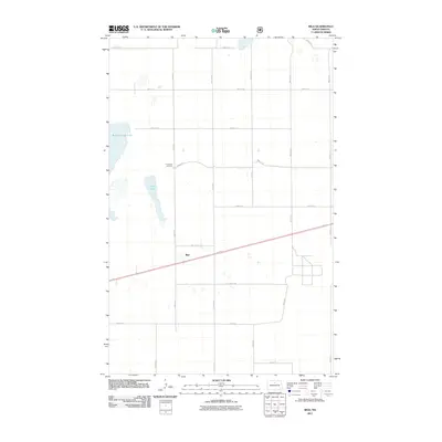
2011 Map of Riga
USGS Topo · Published 2011About this map
Riga sits at the heart of this McHenry County landscape, a small settlement defined by a precise grid of rural roads and the passing tracks of the railroad. The terrain is dominated by significant water bodies to the west, including the expansive Buffalo Lodge Lake and the smaller, north-south oriented Rock Lake. These features, along with scattered wetlands, illustrate the prairie pothole geography characteristic of this part of North Dakota. Evidence of early settlement and local genealogy is anchored by Thompson Cemetery, located north of the town site along 63rd St N. The infrastructure is strictly organized into numbered avenues and streets, such as 6th Ave N and 60th St N, which facilitate movement between the agricultural fields and the central transit corridor running through the township.
Find a feature on this map
19 named features on this map. Tap any name to fly to it.
Don’t see what you’re looking for? This feature index may not catch every label — zoom into the map to look around manually.
Map Details
Editions of this 2011 Riga Map
This is the sole edition of this map. No revisions or reprints were ever made.
Other maps of this area

1948 · Velva
USGS Topo · 1:62,500

1949 · Granville NE
USGS Topo · 1:24,000

1949 · Simcoe
USGS Topo · 1:24,000

1949 · Riga
USGS Topo · 1:24,000

1949 · Karlsruhe NW
USGS Topo · 1:24,000

1949 · Granville
USGS Topo · 1:24,000

1949 · Denbigh
USGS Topo · 1:24,000

1949 · Bantry
USGS Topo · 1:24,000

1950 · Karlsruhe NE
USGS Topo · 1:24,000

1950 · Denbigh
USGS Topo · 1:24,000