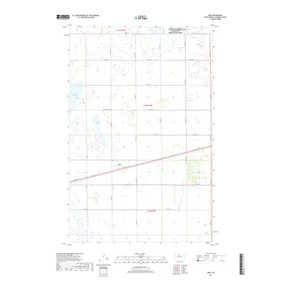
2017 Map of Riga
USGS Topo · Published 2017About this map
Riga sits at the center of this landscape in McHenry County, where the plains of North Dakota are marked by a complex network of glacial potholes and wetlands. The terrain is defined by its water, notably Buffalo Lodge Lake in the northwest and Rock Lake near the center, which together create a vital corridor for migratory birds. This significance is officially recognized in the McHenry County Waterfowl Production Area shown in the northeast corner. For those tracing family roots in the area, the presence of the Thompson Cem near the central section provides a specific point of reference within the rural grid of section lines and township boundaries. The map reflects a region shaped by agricultural geometry, with a meticulous grid of roads such as 66th St N and 4th Ave N connecting the scattered homesteads and water bodies.
Find a feature on this map
23 named features on this map. Tap any name to fly to it.
Don’t see what you’re looking for? This feature index may not catch every label — zoom into the map to look around manually.
Map Details
Editions of this 2017 Riga Map
This is the sole edition of this map. No revisions or reprints were ever made.
Other maps of this area

1948 · Velva
USGS Topo · 1:62,500

1949 · Granville NE
USGS Topo · 1:24,000

1949 · Simcoe
USGS Topo · 1:24,000

1949 · Riga
USGS Topo · 1:24,000

1949 · Karlsruhe NW
USGS Topo · 1:24,000

1949 · Granville
USGS Topo · 1:24,000

1949 · Denbigh
USGS Topo · 1:24,000

1949 · Bantry
USGS Topo · 1:24,000

1950 · Karlsruhe NE
USGS Topo · 1:24,000

1950 · Denbigh
USGS Topo · 1:24,000