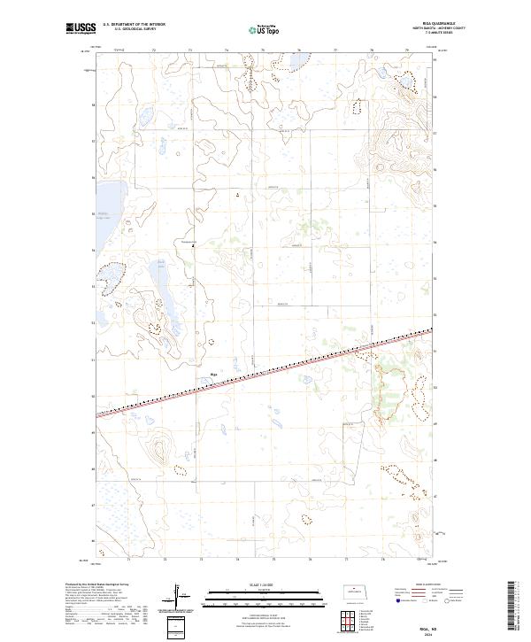
2024 Map of Riga
USGS Topo · Published 2024About this map
Riga sits at a junction of rail and road in this part of McHenry County, where the landscape is defined by the numerous wetlands and glacial lakes characteristic of the region. To the northwest, the significant waters of Buffalo Lodge Lake dominate the edge of the survey, while the smaller Rock Lake lies just north of the settlement. The map provides a clear look at the rural infrastructure of the area, featuring the well-preserved Thompson Cem located in the section north of the rail line. This 2024 edition reflects the modern grid of local roads, such as 57th St N, which serves as a primary east-west artery, and the Denbigh Trl which cuts through the eastern sections. The presence of these specific landmarks and the carefully mapped terrain elevations offer a detailed view of the contemporary North Dakota prairie, revealing how family landmarks and water bodies remain the anchors of this rural community.
Find a feature on this map
17 named features on this map. Tap any name to fly to it.
Don’t see what you’re looking for? This feature index may not catch every label — zoom into the map to look around manually.
Map Details
Editions of this 2024 Riga Map
This is the sole edition of this map. No revisions or reprints were ever made.
Other maps of this area

1948 · Velva
USGS Topo · 1:62,500

1949 · Granville NE
USGS Topo · 1:24,000

1949 · Simcoe
USGS Topo · 1:24,000

1949 · Riga
USGS Topo · 1:24,000

1949 · Karlsruhe NW
USGS Topo · 1:24,000

1949 · Granville
USGS Topo · 1:24,000

1949 · Denbigh
USGS Topo · 1:24,000

1949 · Bantry
USGS Topo · 1:24,000

1950 · Karlsruhe NE
USGS Topo · 1:24,000

1950 · Denbigh
USGS Topo · 1:24,000