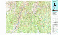
1987 Map of Riggins
USGS Topo · Published 1987About this map
The Salmon River and Snake River systems dominate this late-twentieth-century landscape, carving deep through the Hells Canyon region where the borders of Idaho and Oregon meet. The confluence of the Little Salmon River and the main Salmon River at Riggins serves as a primary focal point, while the towering heights of the Seven Devils Mountains—including He Devil and She Devil—define the high-elevation terrain to the west. Evidence of the region's mining heritage is visible through labels for the Black Bear Mine, US Mine, and Florence Mine.
Find a feature on this map
106 named features on this map. Tap any name to fly to it.
Don’t see what you’re looking for? This feature index may not catch every label — zoom into the map to look around manually.
Map Details
Editions of this 1987 Riggins Map
This is the sole edition of this map. No revisions or reprints were ever made.
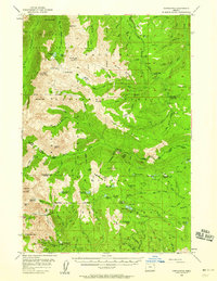
Other maps of this area

1911 · Meadows
USGS Topo · 1:125,000

1915 · Pine
USGS Topo · 1:125,000

1920 · Seven Devils Mining District
USGS Topo · 1:48,000

1922 · He Devil
USGS Topo · 1:48,000

1931 · Buffalo Hump
USGS Topo · 1:125,000

1934 · Buffalo Hump
USGS Topo · 1:125,000

1938 · Riggins
USGS Topo · 1:96,000

1945 · Riggins
USGS Topo · 1:125,000
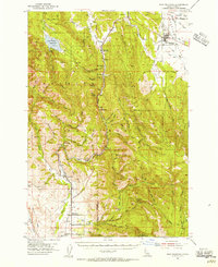
1954 · New Meadows
USGS Topo · 1:62,500
1954 · Cornucopia
USGS Topo · 1:62,500