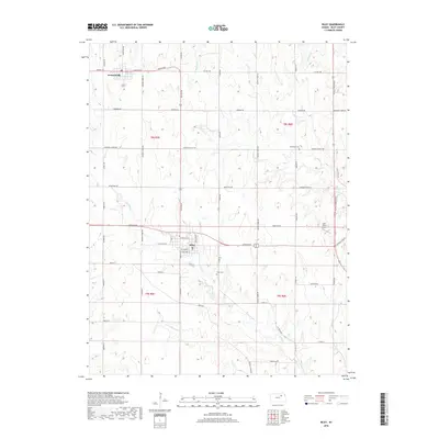
2018 Map of Riley
USGS Topo · Published 2018About this map
Riley and Leonardville anchor this 2018 survey of north-central Kansas, illustrating the enduring grid of agricultural section lines and rural homesteads. The town of Riley shows a detailed street network including W Walnut St and S Main St, while Leonardville sits further north along Barton Rd. This modern digital landscape is deeply etched by a complex drainage system, where Wildcat Cr and its tributaries like Little Arkansas Cr carve through the terrain. Evidence of the region's long-established community structure is found at Grandview Cem and Riley Cem. Transportation and land use are further defined by the proximity of Tuttle Creek Blvd on the eastern edge and the private aviation strip at Leo's Place Airport, marking a shift from traditional farming toward contemporary regional infrastructure.
Find a feature on this map
56 named features on this map. Tap any name to fly to it.
Don’t see what you’re looking for? This feature index may not catch every label — zoom into the map to look around manually.
Map Details
Editions of this 2018 Riley Map
This is the sole edition of this map. No revisions or reprints were ever made.
Other maps of this area

1886 · Junction City
USGS Topo · 1:125,000

1889 · Junction City
USGS Topo · 1:125,000

1894 · Junction City
USGS Topo · 1:125,000

1947 · Manhattan
USGS Topo · 1:62,500

1947 · Fort Riley
USGS Topo · 1:62,500

1950 · Keats
USGS Topo · 1:24,000

1951 · Wind Creek
USGS Topo · 1:24,000

1951 · Milford
USGS Topo · 1:24,000

1955 · Fort Riley NE
USGS Topo · 1:24,000

1955 · Milford
USGS Topo · 1:24,000