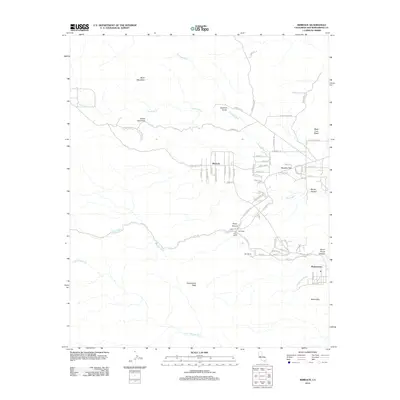
2012 Map of Rimrock
USGS Topo · Published 2012About this map
Rimrock and Pioneertown occupy a high-desert landscape defined by ancient volcanic formations and a network of dry washes in the early 21st century. The map highlights the transition from rugged terrain features like Black Mountain and Black Lava Butte to the small residential and ranching clusters. The layout of roads in Rimrock and Bowden Flat, with names like Wyatt Earp Ln, Gunsight Ln, and Stagecoach Rd, reflects a deliberate nod to the area's cinematic and frontier identity. Isolated ranching sites such as The Pipes Ranch and Kee Ranch are shown near Pipes Wash, while the dramatic rock formations of the Sawtooths and Chaparrosa Peak dominate the southern portion of the quadrangle. These drainage patterns, including Antelope Wash and Little Morongo Cr, provide a clear view of how geography dictated the placement of these high-desert outposts.
Find a feature on this map
75 named features on this map. Tap any name to fly to it.
Don’t see what you’re looking for? This feature index may not catch every label — zoom into the map to look around manually.
Map Details
Editions of this 2012 Rimrock Map
This is the sole edition of this map. No revisions or reprints were ever made.
Other maps of this area

1901 · Southern California Sheet No. 1
USGS Topo · 1:250,000

1902 · San Gorgonio
USGS Topo · 1:125,000

1904 · Southern California Sheet No. 1
USGS Topo · 1:250,000

1953 · San Bernardino
USGS Topo · 1:250,000

1955 · Old Woman Springs
USGS Topo · 1:62,500

1955 · Emerson Lake
USGS Topo · 1:62,500

1955 · Morongo Valley
USGS Topo · 1:62,500

1955 · Joshua Tree
USGS Topo · 1:62,500

1956 · San Bernardino
USGS Topo · 1:250,000

1957 · San Bernardino
USGS Topo · 1:250,000