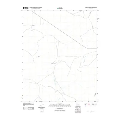
2010 Map of Rincon Marquez
USGS Topo · Published 2010About this map
Chaco Mesa dominates the landscape of this high desert region within the Eastern Navajo Agency, characterized by a complex network of ephemeral drainages and intermittent watercourses. The topography is defined by significant features like Noberto Sandoval Cañon and the extensive Rincon Marquez Arroyo, which channels seasonal runoff through the arid terrain. Human presence is concentrated at the settlement of Rincon Marquez and the Elkins Star Lake Ranch, reflecting the ranching and tribal infrastructure of the early 21st century. The map documents vital transportation corridors through this isolated area, including Indian Service Route 91 and Navajo Service Route 7004, which provide essential access across the mesa and alongside Daniel Wash.
Find a feature on this map
9 named features on this map. Tap any name to fly to it.
Don’t see what you’re looking for? This feature index may not catch every label — zoom into the map to look around manually.
Map Details
Editions of this 2010 Rincon Marquez Map
This is the sole edition of this map. No revisions or reprints were ever made.
Other maps of this area

1883 · Mt. Taylor
USGS Topo · 1:250,000

1886 · Mt. Taylor
USGS Topo · 1:250,000

1892 · Mt. Taylor
USGS Topo · 1:250,000

1899 · Mt. Taylor
USGS Topo · 1:250,000

1958 · Albuquerque
USGS Topo · 1:250,000

1960 · Pueblo Alto Trading Post
USGS Topo · 1:24,000
1961 · Ojo Encino Mesa
USGS Topo · 1:24,000
1961 · Star Lake
USGS Topo · 1:24,000

1961 · Whitehorse Rincon
USGS Topo · 1:24,000

1961 · Mesita Del Gavilan
USGS Topo · 1:24,000