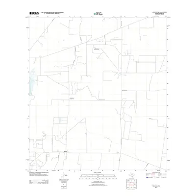
2012 Map of Rincon
USGS Topo · Published 2012About this map
Rincon serves as a central point of activity in this part of Starr County, where the landscape is defined by the intersection of ranching traditions and modern energy extraction. The area is heavily marked by industrial infrastructure, notably the North Rincon Oil and Gas Field and the Cameron Oil and Gas Field, which are connected by a network of utility and transport routes including Pipeline Rd and Conoco Plant Rd. These energy corridors cut across traditional ranching boundaries, indicated by features such as the Pablito Windmill and Cameron Ranch Rd. The local road system, featuring names like Mariscos Ln and Starr Feed Yards Rd, reveals a community shaped by livestock production and agricultural commerce. Sparse residential development like Las Brises appears alongside these established industrial and ranching operations during this period in the early twenty-first century.
Find a feature on this map
22 named features on this map. Tap any name to fly to it.
Don’t see what you’re looking for? This feature index may not catch every label — zoom into the map to look around manually.
Map Details
Editions of this 2012 Rincon Map
This is the sole edition of this map. No revisions or reprints were ever made.
Other maps of this area

1938 · Sal Colorada
USGS Topo · 1:62,500

1939 · La Reforma
USGS Topo · 1:62,500

1940 · Monte Christo
USGS Topo · 1:62,500

1949 · Mc Allen
USGS Topo · 1:250,000

1954 · McAllen
USGS Topo · 1:250,000

1956 · Garcias
USGS Topo · 1:62,500

1957 · Mc Allen
USGS Topo · 1:250,000

1962 · McAllen
USGS Topo · 1:250,000
1963 · McCook
USGS Topo · 1:24,000
1965 · Camp Garcia
USGS Topo · 1:24,000