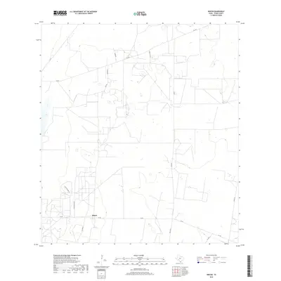
2019 Map of Rincon
USGS Topo · Published 2019About this map
Rincon serves as a central point of reference in this ranching landscape within Starr County, where the infrastructure reflects the region's agricultural and industrial priorities. The intersection of Fm 490 and local routes like Starr Feedyard Rd highlights the logistics of livestock and land management. Significant properties such as the Santa Fe Ranch dominate the terrain, which is otherwise marked by an intricate network of local connectors including Clerks Rd and Rivas Rd. The presence of Pipeline Rd underscores the energy transport role this area plays, while named locales like Las Brisas and El Panel indicate established pockets of settlement and activity along the Farm to Market road system. This survey illustrates the modern layout of South Texas ranchlands, balancing large-scale landholdings with the transit needs of a rural economy.
Find a feature on this map
14 named features on this map. Tap any name to fly to it.
Don’t see what you’re looking for? This feature index may not catch every label — zoom into the map to look around manually.
Map Details
Editions of this 2019 Rincon Map
This is the sole edition of this map. No revisions or reprints were ever made.
Other maps of this area

1938 · Sal Colorada
USGS Topo · 1:62,500

1939 · La Reforma
USGS Topo · 1:62,500

1940 · Monte Christo
USGS Topo · 1:62,500

1949 · Mc Allen
USGS Topo · 1:250,000

1954 · McAllen
USGS Topo · 1:250,000

1956 · Garcias
USGS Topo · 1:62,500

1957 · Mc Allen
USGS Topo · 1:250,000

1962 · McAllen
USGS Topo · 1:250,000
1963 · McCook
USGS Topo · 1:24,000
1965 · Camp Garcia
USGS Topo · 1:24,000