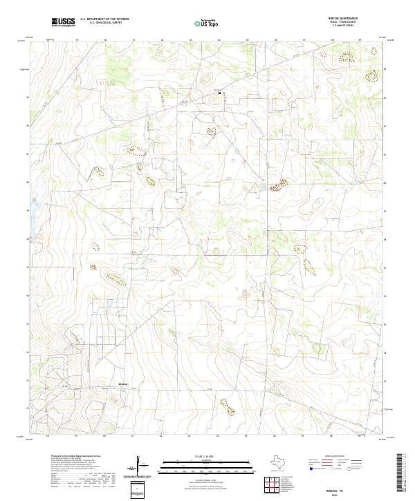
2022 Map of Rincon
USGS Topo · Published 2022About this map
Rincon sits at the junction of several farm-to-market roads in the South Texas brush country, serving as a focal point for the cattle ranching landscape of Starr County. This modern survey illustrates a network of rural routes and ranch roads, including Starr Feedyard Rd and Rivas Rd, which connect remote homesteads and operations like the Santa Fe Ranch. The terrain is characterized by subtle drainage patterns and low-lying depressions, typical of this arid region. For those researching family history in the area, the map precisely locates the Saenz Cem in the northern portion of the quadrangle, north of FM 2294. This specific detail provides a critical spatial record for local genealogy, anchoring long-established family names to the physical landscape. Industrial activity is also evident through the presence of Pipeline Rd, highlighting the infrastructure supporting the region's energy and agricultural sectors.
Find a feature on this map
15 named features on this map. Tap any name to fly to it.
Don’t see what you’re looking for? This feature index may not catch every label — zoom into the map to look around manually.
Map Details
Editions of this 2022 Rincon Map
This is the sole edition of this map. No revisions or reprints were ever made.
Other maps of this area

1938 · Sal Colorada
USGS Topo · 1:62,500

1939 · La Reforma
USGS Topo · 1:62,500

1940 · Monte Christo
USGS Topo · 1:62,500

1949 · Mc Allen
USGS Topo · 1:250,000

1954 · McAllen
USGS Topo · 1:250,000

1956 · Garcias
USGS Topo · 1:62,500

1957 · Mc Allen
USGS Topo · 1:250,000

1962 · McAllen
USGS Topo · 1:250,000
1963 · McCook
USGS Topo · 1:24,000
1965 · Camp Garcia
USGS Topo · 1:24,000