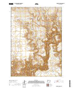
2020 Map of Rinehart Canyon
USGS Topo · Published 2020About this map
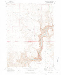
Owyhee River flows through a landscape defined by dramatic canyons and a sophisticated system of high-desert water management in Malheur County. The river's path is carved deeply into Owyhee Canyon, while the surrounding plateau is dotted with numerous small-scale reservoirs such as Gallagher Reservoir, Bower Miller Reservoir, and Stanfield Reservoir. These water features, alongside Rinehart Spring and Hoot Owl Spring, suggest a long-standing reliance on irrigation and livestock watering in this arid region. Human activity is marked by Rinehart Ranch Rd and Miller Ln, providing access to distinct topographic landmarks like Iron Point and Jackson Hole. This 2020 survey illustrates how the drainage patterns of Jackson Cr and Mud Cr continue to shape the utility and settlement of this part of eastern Oregon.
Find a feature on this map
31 named features on this map. Tap any name to fly to it.
Don’t see what you’re looking for? This feature index may not catch every label — zoom into the map to look around manually.
Map Details
Editions of this 2020 Rinehart Canyon Map
This is the sole edition of this map. No revisions or reprints were ever made.
Other maps of this area

1955 · Boise
USGS Topo · 1:250,000

1958 · Boise
USGS Topo · 1:250,000

1962 · Boise
USGS Topo · 1:250,000

1972 · Cedar Mountain
USGS Topo · 1:24,000
1972 · Wrangle Butte
USGS Topo · 1:24,000
1972 · Lambert Rocks
USGS Topo · 1:24,000

1972 · Burnt Flat
USGS Topo · 1:24,000

1972 · Big Mud Flat
USGS Topo · 1:24,000
1972 · Sacramento Butte
USGS Topo · 1:24,000
1972 · Rinehart Canyon
USGS Topo · 1:24,000