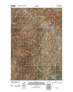
2011 Map of Ring
USGS Topo · Published 2011About this map
Ring appears here as a focal point in the rural northern reaches of Umatilla County, where the high plateaus are carved by seasonal drainages. The landscape is defined by the deep indentation of Vansycle Canyon to the north and the diverging paths of North Juniper Canyon Rd and S Juniper Canyon Rd further south. This 2011 survey illustrates a highly organized grid of county roads and family-named thoroughfares, such as Campbell Rd, Newtson Rd, and Dorran Rd, which reflect the area's deep-rooted agricultural divisions. The network of routes, including Stockman Rd and Kings Corner Rd, suggests a landscape devoted to large-scale dryland farming and ranching, characteristic of the inland Pacific Northwest.
Find a feature on this map
18 named features on this map. Tap any name to fly to it.
Don’t see what you’re looking for? This feature index may not catch every label — zoom into the map to look around manually.
Map Details
Editions of this 2011 Ring Map
This is the sole edition of this map. No revisions or reprints were ever made.
Other maps of this area

1915 · Wallulah
USGS Topo · 1:96,000

1918 · Wallula
USGS Topo · 1:125,000

1935 · Pendleton
USGS Topo · 1:125,000

1953 · Pendleton
USGS Topo · 1:250,000

1953 · Walla Walla
USGS Topo · 1:250,000

1956 · Pendleton
USGS Topo · 1:250,000

1958 · Walla Walla
USGS Topo · 1:250,000

1964 · Wallula
USGS Topo · 1:24,000

1964 · Zangar Junction
USGS Topo · 1:24,000
1966 · Juniper Canyon
USGS Topo · 1:24,000