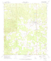
1972 Map of Ringgold
USGS Topo · Published 1974About this map
Ringgold serves as the central hub of this Bienville Parish landscape in the early 1970s, where the agricultural and industrial character of north-central Louisiana is clearly defined. The northern portion is dominated by the Lake Bistineau Gas Field, marked by a network of pipelines and service roads. Small rural settlements like Woodardville and Tullis are connected by a dense web of secondary roads and local landmarks, including the Hall Summit Lookout Tower and a local Landing Strip.
Find a feature on this map
50 named features on this map. Tap any name to fly to it.
Don’t see what you’re looking for? This feature index may not catch every label — zoom into the map to look around manually.
Map Details
Editions of this 1972 Ringgold Map
This is the sole edition of this map. No revisions or reprints were ever made.
Other maps of this area

1941 · East Point
USGS Topo · 1:31,680

1941 · Bossier Point
USGS Topo · 1:31,680

1947 · Ringgold
USGS Topo · 1:62,500

1947 · Ashland
USGS Topo · 1:62,500

1948 · Coushatta
USGS Topo · 1:62,500

1948 · Jamestown
USGS Topo · 1:62,500

1949 · Jamestown
USGS Topo · 1:62,500

1955 · Shreveport
USGS Topo · 1:250,000

1956 · Shreveport
USGS Topo · 1:250,000

1956 · Ringgold
USGS Topo · 1:62,500