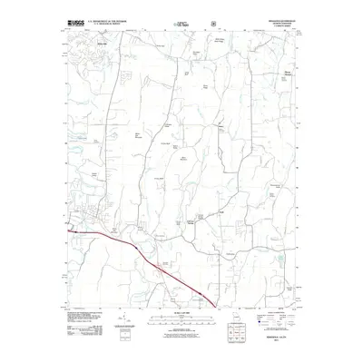
2011 Map of Ringgold
USGS Topo · Published 2011About this map
White Oak Mountain dominates the western landscape of this Georgia-Tennessee border region, carving out distinct valleys such as Rabbit Valley and Cherokee Valley. The terrain is defined by a series of parallel ridges including Baker Ridge and Toney Ridge, which channel a dense network of waterways like South Chickamauga Creek and Tiger Creek. This 2011 survey reveals a mix of rural heritage and modern specialized land use, notably the Catoosa Target Range and the nearby Catoosa Springs Stolport. Local history is anchored by numerous family and community landmarks, from the clusters of houses at Salem and Keith to several established burying grounds including Ebenezer Cemetery and Smiths Chapel Cemetery. The eastern portion transitions into the Mount Vernon Valley, where small-scale water features like Lake Kathy and Little Tiger Creek punctuate the agricultural and residential landscape.
Find a feature on this map
87 named features on this map. Tap any name to fly to it.
Don’t see what you’re looking for? This feature index may not catch every label — zoom into the map to look around manually.
Map Details
Editions of this 2011 Ringgold Map
This is the sole edition of this map. No revisions or reprints were ever made.
Other maps of this area

1886 · Dalton
USGS Topo · 1:125,000

1886 · Cleveland
USGS Topo · 1:125,000

1886 · Ringgold
USGS Topo · 1:125,000

1888 · Chattanooga
USGS Topo · 1:125,000

1892 · Ringgold
USGS Topo · 1:125,000

1892 · Cleveland
USGS Topo · 1:125,000

1892 · Dalton
USGS Topo · 1:125,000

1893 · Chattanooga
USGS Topo · 1:125,000

1895 · Cleveland
USGS Topo · 1:125,000

1897 · Dalton
USGS Topo · 1:125,000