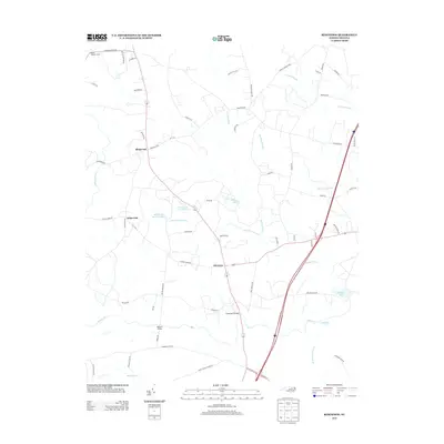
2013 Map of Ringwood
USGS Topo · Published 2013About this map
Medoc Mountain and its Medoc Lookout Tower anchor the northwest corner of this North Carolina landscape, where the terrain is defined by a dense network of named wetlands and waterways. The settlements of Ringwood, White Oak, and Glenview serve as central points along the local road system, which includes routes like Ringwood Rd and Fishing Creek Rd. The region is characterized by extensive swamp systems, notably Jacket Swamp, Breeches Swamp, and Jack Horse Swamp, which suggest a low-lying environment where historical movement was channeled by crossings such as Culpeppers Bridge and Meltons Bridge. Genealogists and local historians can trace family-named landmarks like Bell Acres and various lakes, including Moss Lake and Bellamy Lake, illustrating the rural residential and agricultural patterns that persisted into the early 21st century.
Find a feature on this map
66 named features on this map. Tap any name to fly to it.
Don’t see what you’re looking for? This feature index may not catch every label — zoom into the map to look around manually.
Map Details
Editions of this 2013 Ringwood Map
This is the sole edition of this map. No revisions or reprints were ever made.
Other maps of this area

1953 · Norfolk
USGS Topo · 1:250,000

1961 · Whitakers
USGS Topo · 1:24,000

1961 · Enfield
USGS Topo · 1:24,000

1963 · Ringwood
USGS Topo · 1:24,000

1963 · Red Oak
USGS Topo · 1:24,000

1963 · Essex
USGS Topo · 1:24,000

1963 · Drake
USGS Topo · 1:24,000

1973 · Aurelian Springs
USGS Topo · 1:24,000

1973 · Hollister
USGS Topo · 1:24,000

1974 · Darlington
USGS Topo · 1:24,000