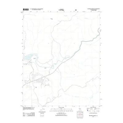
2012 Map of Rio Bravo Ranch
USGS Topo · Published 2012About this map
The Kern River snakes through this landscape northeast of Bakersfield, defining a corridor of recreational and industrial activity. To the west, the Kern River Golf Course and the waters of Lake Ming serve as focal points for the community, while the presence of the Ant Hill Oil Field nearby highlights the region's long-standing connection to resource extraction. The namesake Rio Bravo Ranch occupies a central position in the valley, surrounded by a network of residential streets such as Comanche Dr and Lene Pl that mark the expanding suburban footprint in the early 21st century.
Find a feature on this map
21 named features on this map. Tap any name to fly to it.
Don’t see what you’re looking for? This feature index may not catch every label — zoom into the map to look around manually.
Map Details
Editions of this 2012 Rio Bravo Ranch Map
This is the sole edition of this map. No revisions or reprints were ever made.
Other maps of this area

1906 · Bakersfield
USGS Topo · 1:62,500

1914 · Caliente
USGS Topo · 1:125,000

1920 · Delonagha
USGS Topo · 1:62,500

1926 · Glennville
USGS Topo · 1:62,500

1929 · Bena
USGS Topo · 1:31,680

1929 · Fairfax School
USGS Topo · 1:31,680

1931 · Edison
USGS Topo · 1:31,680

1932 · Bena
USGS Topo · 1:31,680

1932 · Fairfax School
USGS Topo · 1:31,680

1932 · Woody
USGS Topo · 1:62,500