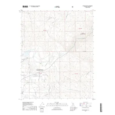
2018 Map of Rio Bravo Ranch
USGS Topo · Published 2018About this map
Rio Bravo Ranch and the eastern outskirts of Bakersfield are the focus of this survey at the meeting point of the San Joaquin Valley and the Sierra Nevada foothills. The landscape is defined by the winding course of the Kern River as it flows out of the highlands, feeding into Lake Ming and passing through the agricultural and residential fringes of the Central Valley. To the northeast, the terrain rises into the Sequoia National Forest, marked by landmarks like Pyramid Hill and the drainage of Rancheria Cr. The map documents a contemporary transition between the urban expansion of Bakersfield and the managed wilderness of the mountains, showing the network of forest routes and local roads like Breckenridge Rd that connect these distinct environments.
Find a feature on this map
46 named features on this map. Tap any name to fly to it.
Don’t see what you’re looking for? This feature index may not catch every label — zoom into the map to look around manually.
Map Details
Editions of this 2018 Rio Bravo Ranch Map
This is the sole edition of this map. No revisions or reprints were ever made.
Other maps of this area

1906 · Bakersfield
USGS Topo · 1:62,500

1914 · Caliente
USGS Topo · 1:125,000

1920 · Delonagha
USGS Topo · 1:62,500

1926 · Glennville
USGS Topo · 1:62,500

1929 · Bena
USGS Topo · 1:31,680

1929 · Fairfax School
USGS Topo · 1:31,680

1931 · Edison
USGS Topo · 1:31,680

1932 · Bena
USGS Topo · 1:31,680

1932 · Fairfax School
USGS Topo · 1:31,680

1932 · Woody
USGS Topo · 1:62,500