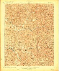
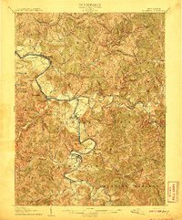
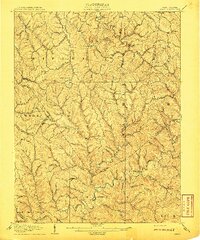
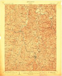
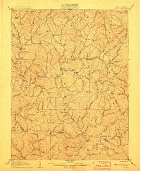
1907 Map of Ripley
USGS Topo · Published 1922About this map
Ripley serves as the focal point of this 1905 survey, where the Baltimore and Ohio Railroad meets the winding course of Mill Creek. The landscape is defined by the sharp ridges and deep hollows of the Appalachian Plateau, crisscrossed by early regional thoroughfares like the Charleston and Parkersburg Turnpike and the Buffalo Turnpike. These routes connected a network of small upland communities and rural landmarks, including Sidneyville, Meadowdale, and Lockhart PO.
Find a feature on this map
99 named features on this map. Tap any name to fly to it.
Don’t see what you’re looking for? This feature index may not catch every label — zoom into the map to look around manually.
Map Details
Editions of this 1907 Ripley Map
This is the sole edition of this map. No revisions or reprints were ever made.
Other maps of this area
1906 · Elizabeth
USGS Topo · 1:62,500

1906 · Belleville
USGS Topo · 1:62,500

1906 · Kenna
USGS Topo · 1:62,500

1906 · Winfield
USGS Topo · 1:62,500

1906 · Walton
USGS Topo · 1:62,500
1907 · Kenna
USGS Topo · 1:62,500
1907 · Spencer
USGS Topo · 1:62,500
1907 · Walton
USGS Topo · 1:62,500

1907 · Keno
USGS Topo · 1:62,500
1908 · Winfield
USGS Topo · 1:62,500