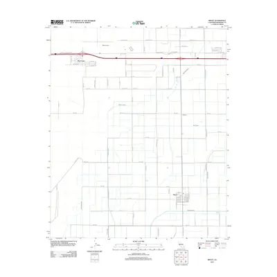
2012 Map of Ripley
USGS Topo · Published 2012About this map
Ripley and its surrounding agricultural landscape appear here in the early 21st century, defined by an intricate network of irrigation and drainage infrastructure in the desert. The settlement pattern is anchored by the community of Mesa Verde near the Interstate corridor and the smaller pocket of Neighbors to the east. A highly organized system of water management dominates the terrain, including the Rannells Drain, Palo Verde Drain, and West Canal, which support the rectilinear farm plots that carve the valley floor. Transportation is centered on the Blythe Airport and a grid of roads such as Old State Hwy and Neighbours Blvd, illustrating the area's continued reliance on efficient transit and water control. This map details the modern persistence of these valley communities, where the Post Office in Ripley remains a focal point for the rural population.
Find a feature on this map
63 named features on this map. Tap any name to fly to it.
Don’t see what you’re looking for? This feature index may not catch every label — zoom into the map to look around manually.
Map Details
Editions of this 2012 Ripley Map
This is the sole edition of this map. No revisions or reprints were ever made.
Other maps of this area

1942 · Blythe
USGS Topo · 1:250,000

1945 · Cibola
USGS Topo · 1:62,500

1951 · Blythe
USGS Topo · 1:24,000

1951 · McCoy Wash
USGS Topo · 1:24,000

1951 · Blythe NE
USGS Topo · 1:24,000

1951 · Cibola
USGS Topo · 1:62,500

1952 · Mule Wash
USGS Topo · 1:24,000

1952 · Mc Coy Spring
USGS Topo · 1:62,500

1952 · Palo Verde
USGS Topo · 1:24,000

1952 · Ripley
USGS Topo · 1:24,000