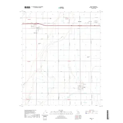
2018 Map of Ripley
USGS Topo · Published 2018About this map
The irrigated landscape of the Palo Verde Valley is defined by an intricate network of waterways, including the W Canal, Township Drain, and S Rannells Drain. This agricultural grid supports the community of Ripley and the southern outskirts of Blythe. To the west, the terrain rises sharply into the Palo Verde Mesa, home to the settlement of Mesa Verde and the Blythe Airport. The map documents a highly managed desert environment where water management is central to the layout of roads and settlements. Near the southern boundary, the Palo Verde Lagoon and Browns Drain signal the complex drainage system necessary to maintain the valley's productivity, while the dry Cinnabar Wash cuts through the northeast, serving as a reminder of the arid natural climate.
Find a feature on this map
67 named features on this map. Tap any name to fly to it.
Don’t see what you’re looking for? This feature index may not catch every label — zoom into the map to look around manually.
Map Details
Editions of this 2018 Ripley Map
This is the sole edition of this map. No revisions or reprints were ever made.
Other maps of this area

1942 · Blythe
USGS Topo · 1:250,000

1945 · Cibola
USGS Topo · 1:62,500

1951 · Blythe
USGS Topo · 1:24,000

1951 · McCoy Wash
USGS Topo · 1:24,000

1951 · Blythe NE
USGS Topo · 1:24,000

1951 · Cibola
USGS Topo · 1:62,500

1952 · Mule Wash
USGS Topo · 1:24,000

1952 · Mc Coy Spring
USGS Topo · 1:62,500

1952 · Palo Verde
USGS Topo · 1:24,000

1952 · Ripley
USGS Topo · 1:24,000