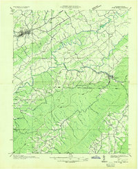
1935 Map of River Knobs
USGS Topo · Published 1935About this map
The South Fork Holston River and its sister forks wind through a complex landscape of ridges and knobs in this 1935 survey. Compiled from early aerial photography by the U. S. Geological Survey and the Tennessee Valley Authority, the map documents the borderlands of Virginia and Tennessee just as the modern conservation era took hold. Social and civic structures are prominently marked, from the Washington Co County Farm and County Convict Camp near Abingdon to the labor camps of the Great Depression, including Camp McArthur CCC and CCC Camp Shelby.
Find a feature on this map
70 named features on this map. Tap any name to fly to it.
Don’t see what you’re looking for? This feature index may not catch every label — zoom into the map to look around manually.
Map Details
Editions of this 1935 River Knobs Map
This is the sole edition of this map. No revisions or reprints were ever made.
Other maps of this area

1891 · Roan Mountain
USGS Topo · 1:125,000

1891 · Abingdon
USGS Topo · 1:125,000

1893 · Cranberry
USGS Topo · 1:125,000

1894 · Roan Mountain
USGS Topo · 1:125,000

1894 · Abingdon
USGS Topo · 1:125,000

1895 · Cranberry
USGS Topo · 1:125,000

1897 · Bristol
USGS Topo · 1:125,000

1899 · Cranberry
USGS Topo · 1:125,000

1902 · Bristol
USGS Topo · 1:125,000

1902 · Cranberry
USGS Topo · 1:125,000