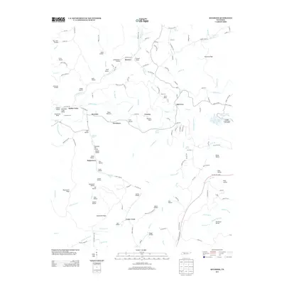
2013 Map of Riverside
USGS Topo · Published 2013About this map
The Buffalo River meanders through this Lewis County landscape, defining the geography of rural settlements like Riverside and Voorhies. This terrain is deeply etched by narrow hollows bearing names that suggest a history of early agriculture and industry, such as Slaughter Pen Hollow, Coaling Hollow, and the Rockhouse Creek Valley. The presence of Slag-Pile Pond near Locust Hollow points toward the region's historical iron production, while the modern Palmer Village-Napier Lake Airport sits near the eastern edge. Along the southern border, the Natchez Trace Pkwy follows the ancient path across Buttermilk Ridge, connecting local roads like Brush Creek Cemetery Rd to the broader regional network near Turkey Track.
Find a feature on this map
164 named features on this map. Tap any name to fly to it.
Don’t see what you’re looking for? This feature index may not catch every label — zoom into the map to look around manually.
Map Details
Editions of this 2013 Riverside Map
This is the sole edition of this map. No revisions or reprints were ever made.
Other maps of this area

1901 · Colombia
USGS Topo · 1:125,000

1905 · Waynesboro
USGS Topo · 1:125,000

1936 · Riverside
USGS Topo · 1:24,000

1936 · Graves Spring
USGS Topo · 1:24,000

1936 · Deerfield
USGS Topo · 1:24,000

1936 · Henryville
USGS Topo · 1:24,000

1936 · Negro Hollow
USGS Topo · 1:24,000

1936 · Kimmins
USGS Topo · 1:24,000

1936 · Topsy
USGS Topo · 1:24,000

1936 · Gordonsburg
USGS Topo · 1:24,000