
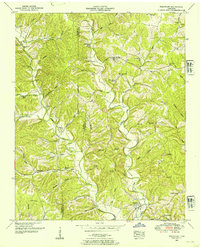
1936 Map of Deerfield
USGS Topo · Published 1936About this map
The Little Buffalo River and its numerous tributaries, including Wolfpen Branch and Dry Branch, carve through the rural landscape of Lawrence County in the mid-1930s. Compiled from aerial photographs by the Tennessee Valley Authority and U.S. Geological Survey, this map reveals a settlement pattern tied closely to ridges and creek valleys. Community life is anchored by dispersed rural institutions such as Greenwood Ch, Macedonia Ch, and Howardville Sch. Along State Highway No 15 and State Highway No 64, small hubs like Deerfield and Red Hill provide central points for the surrounding farmsteads. A notable industrial feature, a Mine, sits in the northwest near Mine Branch, while the southeastern portion of the map is defined by family-named landscape features like Grandaddy Hollow and Kelso Hollow, reflecting the deep-rooted local history of this Tennessee region before post-war modernization.
Find a feature on this map
65 named features on this map. Tap any name to fly to it.
Don’t see what you’re looking for? This feature index may not catch every label — zoom into the map to look around manually.
Map Details
Editions of this 1936 Deerfield Map
This is the sole edition of this map. No revisions or reprints were ever made.
Other maps of this area

1905 · Waynesboro
USGS Topo · 1:125,000

1936 · Riverside
USGS Topo · 1:24,000

1936 · Westpoint
USGS Topo · 1:24,000

1936 · Henryville
USGS Topo · 1:24,000

1936 · Lawrenceburg
USGS Topo · 1:24,000

1936 · Ethridge
USGS Topo · 1:24,000

1936 · Long Branch
USGS Topo · 1:24,000

1936 · Crestview
USGS Topo · 1:24,000

1936 · Ovilla
USGS Topo · 1:24,000
1950 · Westpoint
USGS Topo · 1:24,000