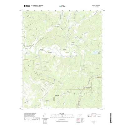
2019 Map of Riverside
USGS Topo · Published 2019About this map
The Buffalo River meanders through this portion of Lewis County, carving a landscape defined by deep hollows and high ridges like Newburg Ridge and Waynesboro Ridge. Small rural settlements such as Riverside, Kitchens, and Voorhies anchor the community, while the industrial legacy of the region is quietly marked by the Slag Pile Pond near Locust Hollow. In the southeastern corner, the Natchez Trace Parkway cuts across the terrain, passing near Laurel Hill Cemetery.
Find a feature on this map
172 named features on this map. Tap any name to fly to it.
Don’t see what you’re looking for? This feature index may not catch every label — zoom into the map to look around manually.
Map Details
Editions of this 2019 Riverside Map
This is the sole edition of this map. No revisions or reprints were ever made.
Other maps of this area

1901 · Colombia
USGS Topo · 1:125,000

1905 · Waynesboro
USGS Topo · 1:125,000

1936 · Riverside
USGS Topo · 1:24,000

1936 · Graves Spring
USGS Topo · 1:24,000

1936 · Deerfield
USGS Topo · 1:24,000

1936 · Henryville
USGS Topo · 1:24,000

1936 · Negro Hollow
USGS Topo · 1:24,000

1936 · Kimmins
USGS Topo · 1:24,000

1936 · Topsy
USGS Topo · 1:24,000

1936 · Gordonsburg
USGS Topo · 1:24,000