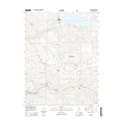
2015 Map of Riverton
USGS Topo · Published 2015About this map
The South Fork American River carves a deep path through the southern portion of this Sierra Nevada landscape, where the El Dorado Fwy follows the river's course past small settlements like Riverton and White Hall. To the north, the terrain rises toward Big Hill Ridge and Government Ridge, much of which is contained within the Eldorado National Forest. This 2015 survey reveals the complex water management infrastructure of the region, including the Union Valley Reservoir and Junction Reservoir, as well as the historic El Dorado Ditch winding along the steep canyon walls. Researchers can identify local landmarks and homesteads such as McConnel Place and Short Place, which reflect the area's history of high-elevation mountain living and resource development between Silver Creek and Esmeralda Cr.
Find a feature on this map
53 named features on this map. Tap any name to fly to it.
Don’t see what you’re looking for? This feature index may not catch every label — zoom into the map to look around manually.
Map Details
Editions of this 2015 Riverton Map
This is the sole edition of this map. No revisions or reprints were ever made.
Other maps of this area

1889 · Pyramid Peak
USGS Topo · 1:125,000

1891 · Placerville
USGS Topo · 1:125,000

1891 · Pyramid Peak
USGS Topo · 1:125,000

1892 · Placerville
USGS Topo · 1:125,000

1893 · Placerville
USGS Topo · 1:125,000

1895 · Pyramid Peak
USGS Topo · 1:125,000

1896 · Pyramid Peak
USGS Topo · 1:125,000

1947 · Sacramento
USGS Topo · 1:250,000

1948 · Sacramento
USGS Topo · 1:250,000

1950 · Riverton
USGS Topo · 1:24,000