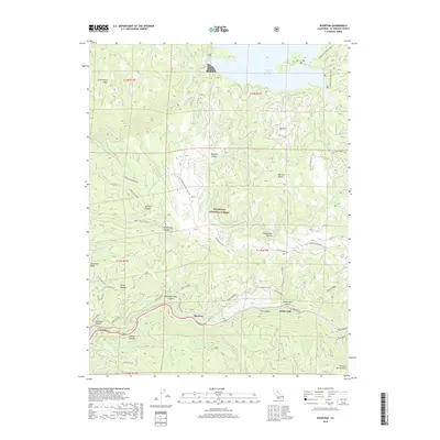
2018 Map of Riverton
USGS Topo · Published 2018About this map
The South Fork American River carves a deep path through this section of the Eldorado National Forest, where the settlement of Riverton serves as a historic crossing point along the El Dorado Fwy. The landscape is defined by its complex topography and water management systems, including the El Dorado Ditch and the expansive Union Valley Reservoir to the north. Historical transportation routes are prominent, most notably the legendary Pony Express trail as it winds through Twentyfive Mile Canyon toward White Hall. Moving away from the river, the terrain rises into high ridges and canyons such as Government Ridge and Big Hill Canyon. These areas are accessed by a network of forest roads and specialized routes like the Big Hill Lookout Rd and the Jaybird Power House Rd, reflecting the region's history of resource management and hydroelectric development.
Find a feature on this map
59 named features on this map. Tap any name to fly to it.
Don’t see what you’re looking for? This feature index may not catch every label — zoom into the map to look around manually.
Map Details
Editions of this 2018 Riverton Map
This is the sole edition of this map. No revisions or reprints were ever made.
Other maps of this area

1889 · Pyramid Peak
USGS Topo · 1:125,000

1891 · Placerville
USGS Topo · 1:125,000

1891 · Pyramid Peak
USGS Topo · 1:125,000

1892 · Placerville
USGS Topo · 1:125,000

1893 · Placerville
USGS Topo · 1:125,000

1895 · Pyramid Peak
USGS Topo · 1:125,000

1896 · Pyramid Peak
USGS Topo · 1:125,000

1947 · Sacramento
USGS Topo · 1:250,000

1948 · Sacramento
USGS Topo · 1:250,000

1950 · Riverton
USGS Topo · 1:24,000