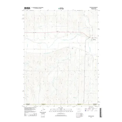
2014 Map of Riverton
USGS Topo · Published 2014About this map
The Republican River dominates this landscape along the border of Nebraska and Kansas, where the community of Riverton serves as the local hub. This area of Franklin County is defined by its sophisticated water management systems, including the Franklin Canal, the Franklin S Side Pump Canal, and several upland water bodies like Kugler Reservoir and Sindt Reservoir. These features reflect the agricultural necessity of moving water across the high plains.
Find a feature on this map
37 named features on this map. Tap any name to fly to it.
Don’t see what you’re looking for? This feature index may not catch every label — zoom into the map to look around manually.
Map Details
Editions of this 2014 Riverton Map
This is the sole edition of this map. No revisions or reprints were ever made.
Other maps of this area

1893 · Smith Center
USGS Topo · 1:125,000

1897 · Red Cloud
USGS Topo · 1:125,000

1940 · Red Cloud
USGS Topo · 1:62,500

1942 · Red Cloud
USGS Topo · 1:62,500

1955 · Grand Island
USGS Topo · 1:250,000

1955 · Beloit
USGS Topo · 1:250,000

1957 · Grand Island
USGS Topo · 1:250,000

1958 · Grand Island
USGS Topo · 1:250,000

1959 · Beloit
USGS Topo · 1:250,000
1973 · Cora
USGS Topo · 1:24,000