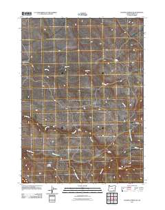
2011 Map of Roaring Springs SE
USGS Topo · Published 2011About this map
Scattered homesteads and high-desert water sources define this region of Harney County, where ranching legacies are recorded in the names of family settlements. The landscape is marked by the presence of the Iven Stephens Homestead, Warren Stephens Homestead, and Carter Homestead, indicating a pattern of land use centered on available water. Significant riparian features like the Donner und Blitzen River and the ephemeral drainage of Dry Creek dictate the movement across this terrain, with established waypoints such as Lower Crossing and Upper Crossing providing essential passage. The map also identifies remote outposts like Lauserica Camp and Huffman Camp, which likely served as seasonal bases for livestock management. This 2011 survey by the U.S. Geological Survey preserves the names of these isolated domestic sites, offering a clear view of the area's human geography and its reliance on the drainage basins of Home Creek and Threemile Creek.
Find a feature on this map
14 named features on this map. Tap any name to fly to it.
Don’t see what you’re looking for? This feature index may not catch every label — zoom into the map to look around manually.
Map Details
Editions of this 2011 Roaring Springs SE Map
This is the sole edition of this map. No revisions or reprints were ever made.
Other maps of this area

1955 · Adel
USGS Topo · 1:250,000

1957 · Adel
USGS Topo · 1:250,000

1958 · Adel
USGS Topo · 1:250,000

1962 · Adel
USGS Topo · 1:250,000

1967 · Roaring Springs
USGS Topo · 1:24,000

1968 · Tombstone Canyon
USGS Topo · 1:24,000

1968 · Fish Lake
USGS Topo · 1:24,000

1968 · Roaring Springs SE
USGS Topo · 1:24,000

1968 · Ankle Creek
USGS Topo · 1:24,000

1971 · Garrison Lake
USGS Topo · 1:24,000