
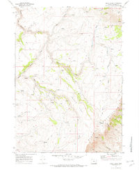
1968 Map of Ankle Creek
USGS Topo · Published 1972About this map
The Donner und Blitzen River winds through this high-desert landscape in Harney County, illustrating the isolated ranching and grazing life of the late 1960s. The map captures a series of remote outposts and family-named landmarks, including the Bill Taber Cabin and the Riley Huff Place. These sites, along with the Madarieta Cabin, indicate a history of seasonal habitation and livestock management in the shadow of Steens Mountain. Water is the defining resource here, marked by numerous Springs and the designated Public Waterhole. The network of Jeep Trails and the Spring Trail snake across Eusabio Ridge, connecting high-elevation grazing lands like Penland Meadow to the drainages of Ankle Creek and Deep Creek. This topographical study provides a detailed record of the essential infrastructure—from corrals to fords—required to sustain life and work in this corner of the Great Basin.
Find a feature on this map
25 named features on this map. Tap any name to fly to it.
Don’t see what you’re looking for? This feature index may not catch every label — zoom into the map to look around manually.
Map Details
Editions of this 1968 Ankle Creek Map
2 editions found
Other maps of this area

1955 · Adel
USGS Topo · 1:250,000

1957 · Adel
USGS Topo · 1:250,000

1958 · Adel
USGS Topo · 1:250,000

1962 · Adel
USGS Topo · 1:250,000

1968 · Tombstone Canyon
USGS Topo · 1:24,000

1968 · Fish Lake
USGS Topo · 1:24,000

1968 · Wildhorse Lake
USGS Topo · 1:24,000

1968 · Roaring Springs SE
USGS Topo · 1:24,000

1968 · Alvord Hot Springs
USGS Topo · 1:24,000

1971 · Andrews
USGS Topo · 1:24,000