
1968 Map of Alvord Hot Springs
USGS Topo · Published 1972About this map
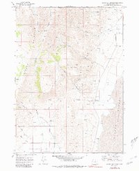
Steens Mountain dominates the western portion of this 1968 landscape, its steep slopes giving way to a network of drainage systems including Wildhorse Creek and Pike Creek. The map documents a stark transition from high-elevation peaks down to the flat, low-lying floor of the Alvord Desert (Depression) and Wildhorse Valley. Human activity is marked by thermal features and early infrastructure, notably the Alvord Hot Springs and Belzar Spring. Evidence of prospecting is scattered throughout the canyons, with labels for a Mine, various prospects, and a set of Ruins. The presence of a Flume and Aqueduct near the eastern margin suggests the critical importance of water management in this arid environment, where isolated springs provided the only reliable water sources for early ranching and mining efforts in Harney County.
Find a feature on this map
25 named features on this map. Tap any name to fly to it.
Don’t see what you’re looking for? This feature index may not catch every label — zoom into the map to look around manually.
Map Details
Editions of this 1968 Alvord Hot Springs Map
3 editions found
Other maps of this area

1955 · Adel
USGS Topo · 1:250,000

1957 · Adel
USGS Topo · 1:250,000

1958 · Adel
USGS Topo · 1:250,000

1962 · Adel
USGS Topo · 1:250,000

1968 · Fish Lake
USGS Topo · 1:24,000

1968 · Wildhorse Lake
USGS Topo · 1:24,000

1968 · Ankle Creek
USGS Topo · 1:24,000

1971 · Andrews
USGS Topo · 1:24,000

1971 · V Lake
USGS Topo · 1:24,000

1981 · Tule Springs
USGS Topo · 1:24,000